The Route des Crêtes

The Route des Crêtes is a long, winding road linking La Ciotat to Cassis, and is an integral part of the Parc national des Calanques.

Breathtaking views

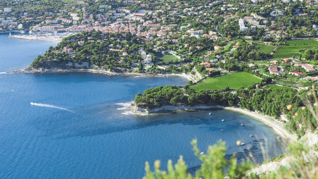
Viewpoints are set out along the roadside to allow you to admire the exceptional panorama of the Bay of La Ciotat, with the old town and Île Verte in the background. Further along the route, the Massif des Calanques plunges sumptuously into the sea. On a clear day, you can see the Marseille island chain.

A lovely walk

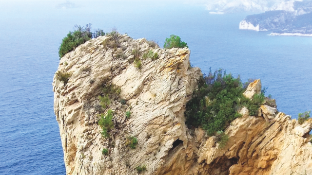
Along the way, you can see some spectacularly shaped rocks, such as Le Pont Naturel, a natural arch carved out by erosion, and the Dent du Chat, an astonishing stone arch. Finally, we reach the Semaphore, which dates back to 1791 and stands at an altitude of 349m. It is here that a military domain controls navigation and ensures the safety of yachtsmen.

The Heart of Honoré

At the start of the Route des Crêtes, you can see the Coeur d’Honoré site. This is a 7-hectare plot of land, laid out in terraces, with ruins of dwellings and a heart-shaped surrounding wall. Honoré was the owner in the early 19th century, hence the name.

Main panoramic viewpoints

Identity card
  • Year of inauguration: 1964
  • Towns served: La Ciotat and Cassis
  • Highest point: La Grande Tête – 399m
  • Number of kilometres: 17 km
  • Main access: Av. Marcel Camusso

Hiking

around the Route des Crêtes

Did you know?

  • The Route des Crêtes has been the location for many film shoots
  • Stéphane Rotenberg mentioned it in his book Les plus belles routes de France (The most beautiful roads in France)

Good to know

Check whether the Route des Crêtes is open by visiting our Access to the Massifs page!

Find out more

in the Calanques National Park